One more push on this front and then I’ll shake things up a bit and change focus. To restate, I’m trying to get an understanding of why the particular species of trees (and smaller plants) that grow in one location can vary so much from another location, even when these locations are very close together. In recent posts I’ve been coming to terms with the importance of the underlying geology in determining soil type, and then layering in the impact of moisture levels and geographic conditions in particular topographic zones.
In searching around for a fuller understanding I’ve learned that not only have researchers from various disciplines been working on this for a long time, but that government agencies have been building detailed records of this information and the shifting conceptual frameworks for understanding it. The NSW government has adopted a pyramid-shaped Vegetation Classification Framework, with some 1,846 distinct Plant Community Types at the base, which cluster up into 99 distinct native Vegetation Classes, which in turn cluster up further into 12 distinct Vegetation Formations at the top of the hierarchy.
It has been a great eye-opener for me to discover the diversity of plant life in a given area. For example, in our small area of Bunga, seven of the twelve overarching Vegetation Formation patterns are present: Dry Sclerophyll Forests, Wet Sclerophyll Forests, Rain Forests, Wooded Heathlands, Forested Wetlands, Grasslands, Grassy Woodlands and Saline Wetlands. But it is when we drop to the most granular level of the classification hierarchy — Plant Community Types (PCTs) — that the variety of indidivual plant species typically coexisting becomes apparent.
And coexist turns out to be the key word. What I’m beginning to understand is that the question I’ve been pursuing — why does this tree grow here and that tree grow there — is the wrong question. Or rather, it’s not simply a matter of the tree species that grow here and the tree species that grow there, and more a case of the community of plant species that grow here and the community of plant species that grow there.
Following Keith (2004), a PCT is formally defined as a recurring pattern “of native plant species assemblages in relation to environmental conditions such as soil, temperature, moisture and other factors. Their floristic composition is characterised by frequently co-occurring species, including combinations of trees, shrubs and/or groundcover plants.” Or, more simply: recurring groups of plants large and small that coexist when the necessary mix specific conditions is present (eg soil, temperature and moisture).
Up till now, I’ve been coming at this by investigating underlying or enabling factors, but using a plant community perspective approaches it from the other end: looking at the combinations of plants large and small that are typically found together. The NSW Government’s Trees Near Me app, brings all this together with readily accessible and mobile digitised spatial mapping, showing current PCTs and an estimate of likely PCTs before Europeans began clearing the land. It is a tremendous tool. Below is a screenshot from the app showing PCTs in an approximately 1sq km area in the part of Bunga where we live.
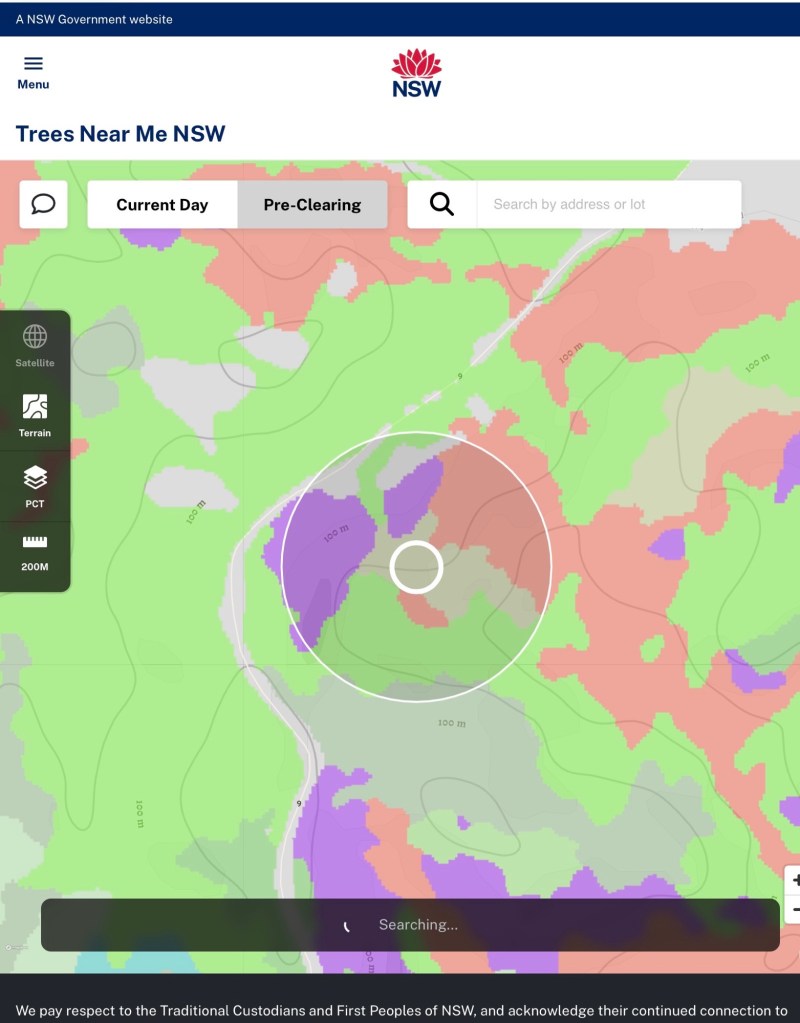
To take three of the most conspicuous PCTs here: the light green colour maps the Southeast Foothills Woollybutt Dry Shrub Forest PCT, the purple colour maps the South Coast Stringybark-Monkey Gum Wet Forest PCT and the coral pink colour maps the South Coast Temperate Gully Rainforest PCT. (If we zoomed out to take in more of the Bunga area, a wider variety of PCTs would be visible.)
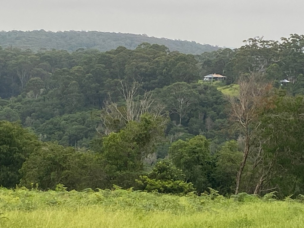
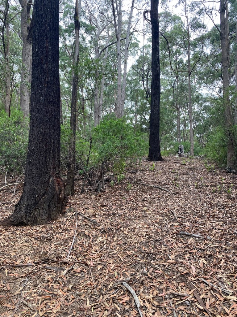
It’s not just that some particular trees are present in one spot and are suddenly not present a short distance away, it’s that the whole plant community largely changes. Quite suddenly, the look and feel is very different. The Dry Shrub Forest (light green) is concentrated along exposed ridge lines and northerly facing slopes where the soil is most denuded and moisture levels are lowest. It features large Woollybuts (Eucalptus longifolia) and Coastal Grey Boxes (Eucalptus bosistiana) interspersed with a sparse mid-layer of Sticky Bower Wattle (Acacia subporosa), as well as native cherries (Exocarpyus cupressiformus) and Shrubby Platysace (Platysace lanceolata).
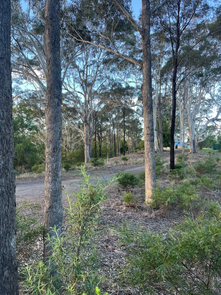
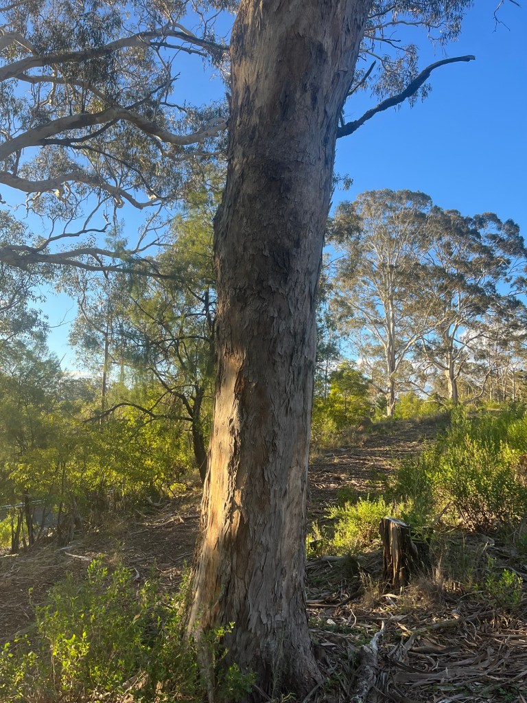
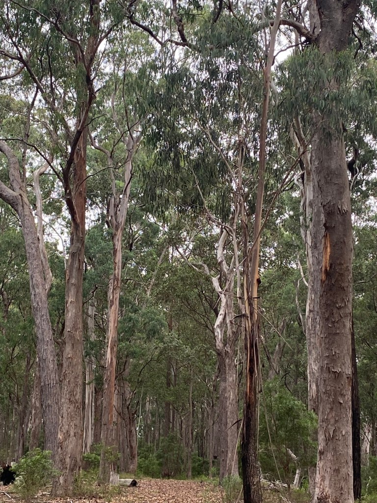
By contrast, the Wet Forest (purple) appears on less exposed and less denuded slopes and features very tall Monkey Gum (Eucalyptus cypellocarpa), Yellow Stringybark (Eucalyptus meullerinana) and some Red Ironbark (Eucalyptus tricarpa) together with a greener understory including Rough-fruited Pittosporum (Pittosporum revolutum), Mock Olive (Notelaea longifolia) and Spicy Everlasting (Ozothamnus argophyllus).
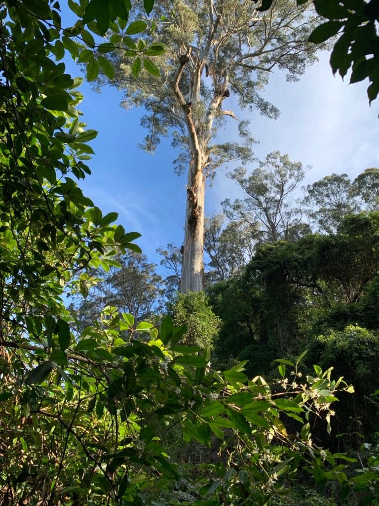
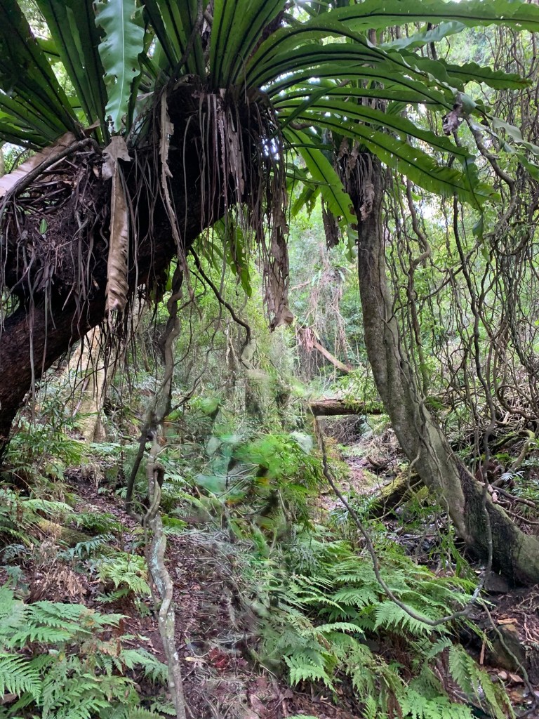
In even starker contrast, the Temperate Gully Rainforest (coral pink) is lower down in the most sheltered gullies with the best soil and highest moisture levels and features very tall to extremely tall Monkey Gums (Eucalyptus cypellocarpa), trees such as Pencil Cedars (Polyscias murrayi), Sassafras (Dorryphora sassafras), Koda (Ehretia acuminata) and Sweet Pittosporum (Pittosporum undulatum) and then a dense green understory of ferns, vines and smaller trees such as Mutton Wood (Myrsine howitana), and Sandpaper Fig (Ficus coronata).
Two main thoughts remain with me as I wrap up this push over the past six months to understand better why plant species vary so much within a small area. The first is a sense of renewed optimism about the possibility for the human species to do a better a job as custodians of the land and biodiversity. To be sure, there are countless ecological threats, but at least in this part of the world, government is empowering landholders and interested members of the community with startlingly useful information on plant species and soil types in readily accessible and mobile-friendly digital formats. These are powerful tools to aid environmental rehabilitation.
And the second is sheer wonder and delight as I become more aware of the amazing diversity of plant species that exist within one small area, and indeed coexist as recognisable and recurring plant communities. I’m not sure whether to feel bad about having gone so far through my life oblivious to this magnificent complexity, or thankful to have finally become alive to it. Anyway, that’s it for a while on plant species. I’m going to take my adventures in the natural history of Bunga in a new direction over the next few months
References
Keith, D.A. 2004. Ocean Shores to Desert Dunes: The Native Vegetation of New South Wales and the ACT, NSW Department of Environment and Heritage, Sydney.
NSW Government. Trees Near Me, NSW Department of Environment and Heritage. Sydney. Link
NSW Government. Soils Near Me, NSW Department of Environment and Heritage, Sydney. Link
NSW Government. The NSW Vegetation Classification Framework, NSW Department of Environment and Heritage, Sydney. Link

Leave a comment