I suppose questions of “where” and “what” are as a good a place to start as any! The area where I live on the far south coast of NSW is known locally as Bunga. But finding out just where and what Bunga is, is not easy.
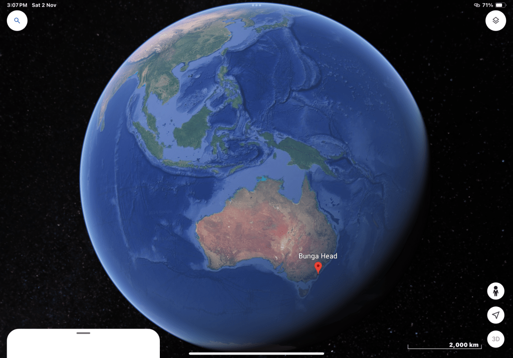
Google Maps will give you a dot point here. But Bunga is an area, not a point, so where does it begin and end? How far does it stretch? And what is its locational status or classification? I’m coming to realise that the answer to these questions depends on the time period to which one is referring. The NSW Government Land Titles Office gives Bunga’s official designation as a “Rural Place”. In 1999, the Government Gazette of the State of New South Wales (29/01/1999, Issue No. 12) recorded that Bunga was one of a number of localities in the Bega Valley Shire that would henceforth have the designation of “Historical Locality”. In other words, it was once a recognised location but since 1999 has been downgraded for official purposes.
Historical records show that when the first Europeans settled on the land where I now live — Mark and Sarah Jones who came here in the early 1880s — the parcel of land they “selected” for acquisition from the NSW Government was described as being at Bunga. Note that this was the high colonial period and their nominal payment for the land was to the government, not any locally resident indigenous person or group — a subject to explored later. Twenty years later, the Parish map of Murrah — a larger geographic district encompassing Bunga — also has multiple clear references to Bunga.
I wonder if the First Nations people — the Djiringanj people of the Yuin nation who lived here before the coming of the Europeans — had any natural geographic boundary identifiers for Bunga. And what of the name “Bunga”? Like so many other place names on the far south coast of NSW, Bunga is clearly an indigenous name. The NSW Geographical Names Board indicates that Bunga means “tail”. However preliminary local inquiries suggest the word may have meant “fighting ground” or “thunder ground” to the local Djiringanj people. Was there fighting when Europeans first came to this area, and, as in so many other areas forced dispossession of local peoples? Or was there some older origin of the name? Again, something to be explored further.
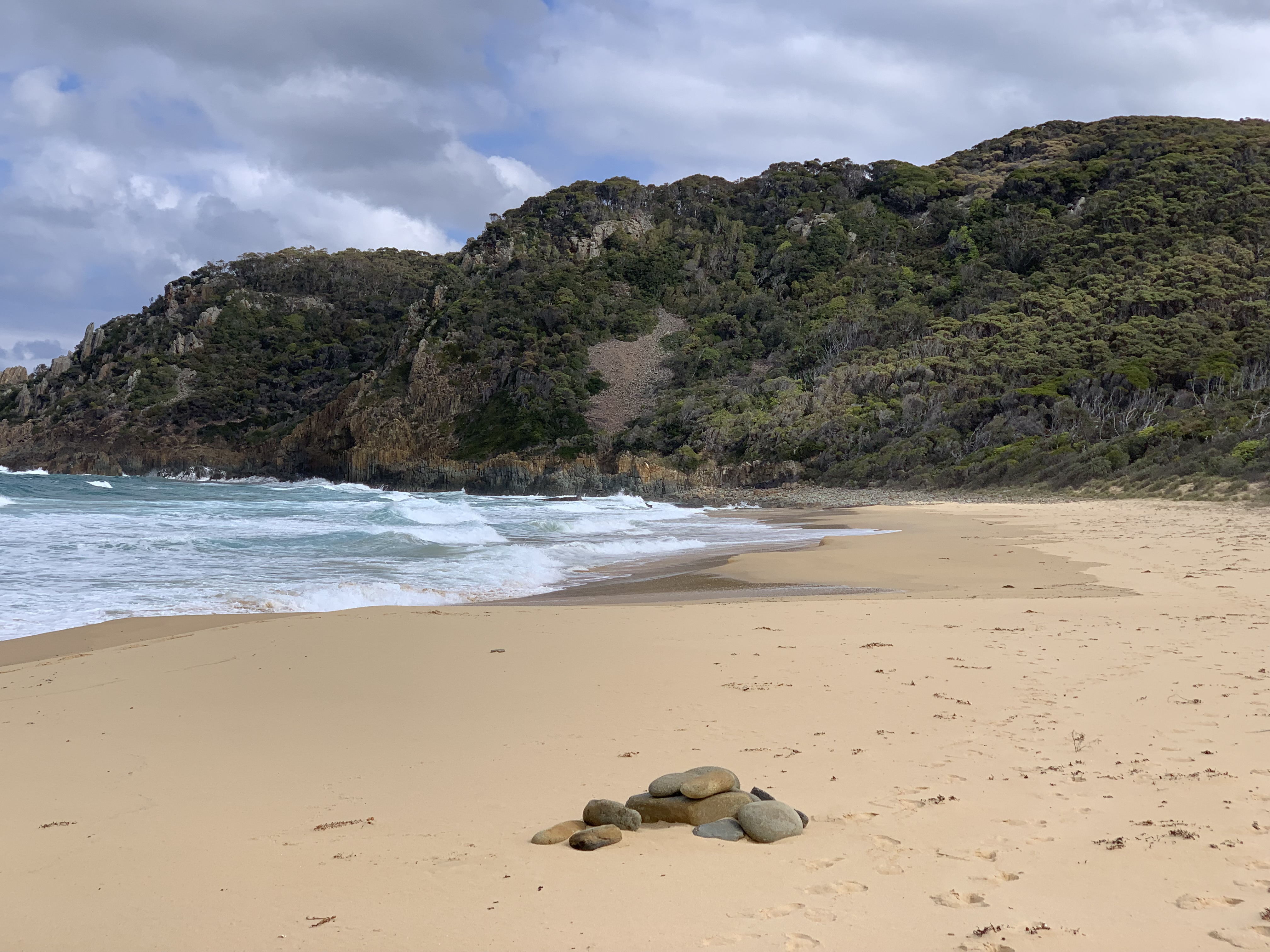
Having regard for historical maps and clearly named geographical features today, it seems reasonable to suppose that the Rural Place or Historical Locality of Bunga is about 15 square kilometres. In this reckoning, it has the Pacific Ocean as its eastern boundary, stretching from Bunga Head (picture below) in the south to Bunga Road in the north coming out at Bunga Beach; and on the western side, stretching from about Bunga Pinch Road in the south to somewhere near Benny Gowans Road in the north.
But let’s not be detained too long with geographic uncertainties. My aim in this post is just to give some idea of where this place is located, before starting to scratch a bit deeper in exploring its natural history. And by this, I mean how species of plant and animal (including we humans) have interacted with each other and the environment over time. If you have any comments, questions or thoughts on any of this, I’d be very pleased to hear from you.


Leave a comment